GTFS Editor
Chartr's GTFS Editor lets any transit agency create, edit and publish standardised route and stop data — without writing a single CSV file. Build the dataset once; it works everywhere.
India's First
Open GTFS dataset for buses in India
Multiple
Cities with open GTFS data
0
CSV files needed
Any size
Works for any transit network
The Standard
What is GTFS?
GTFS (General Transit Feed Specification) is the global open standard for describing public transport networks. It was created by Google and Portland TriMet in 2006 and is now used by every major map app in the world.
A GTFS feed is a set of structured files that describe your transit network — routes, stops, trips, schedules and shapes. When you publish a GTFS feed, your buses automatically appear in Google Maps, Apple Maps, Citymapper and any other app that reads GTFS data.
Without GTFS, your transit network is invisible to riders. With it, any app in the world can show your buses without any custom integration.
Read the official GTFS docsRoutes
Every bus route in your network — route number, name, type and colour.
Stops
Every physical bus stop — name, GPS coordinates and accessibility info.
Trips & Schedules
When each bus runs, in which direction, and on which days of the week.
Shapes
The exact path a bus travels between stops — drawn on the map.
Fares
Ticket prices, fare rules and zone information for the network.
The Editor
Everything in one tool
Real screenshots from Chartr's GTFS Editor used by DIMTS and DTC to manage Delhi's bus network.
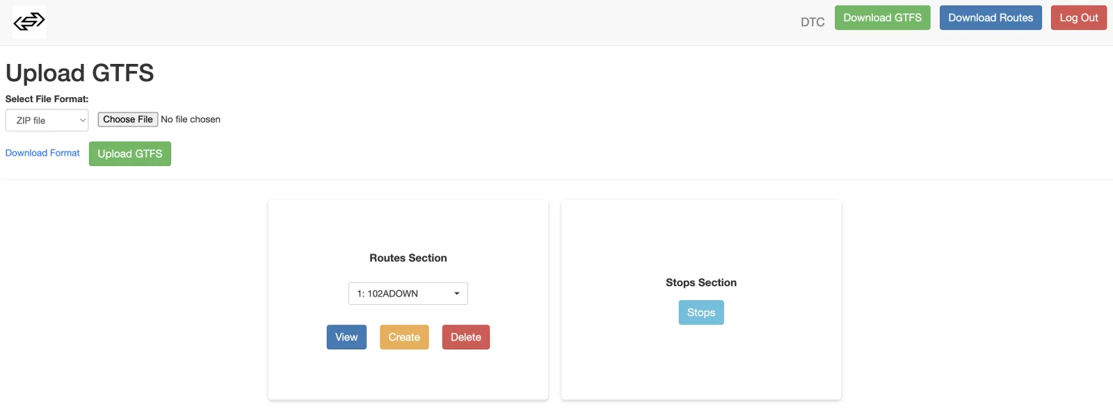
Upload & Manage
Upload an existing GTFS ZIP file to get started, or build your network from scratch. Manage multiple agencies from one dashboard.
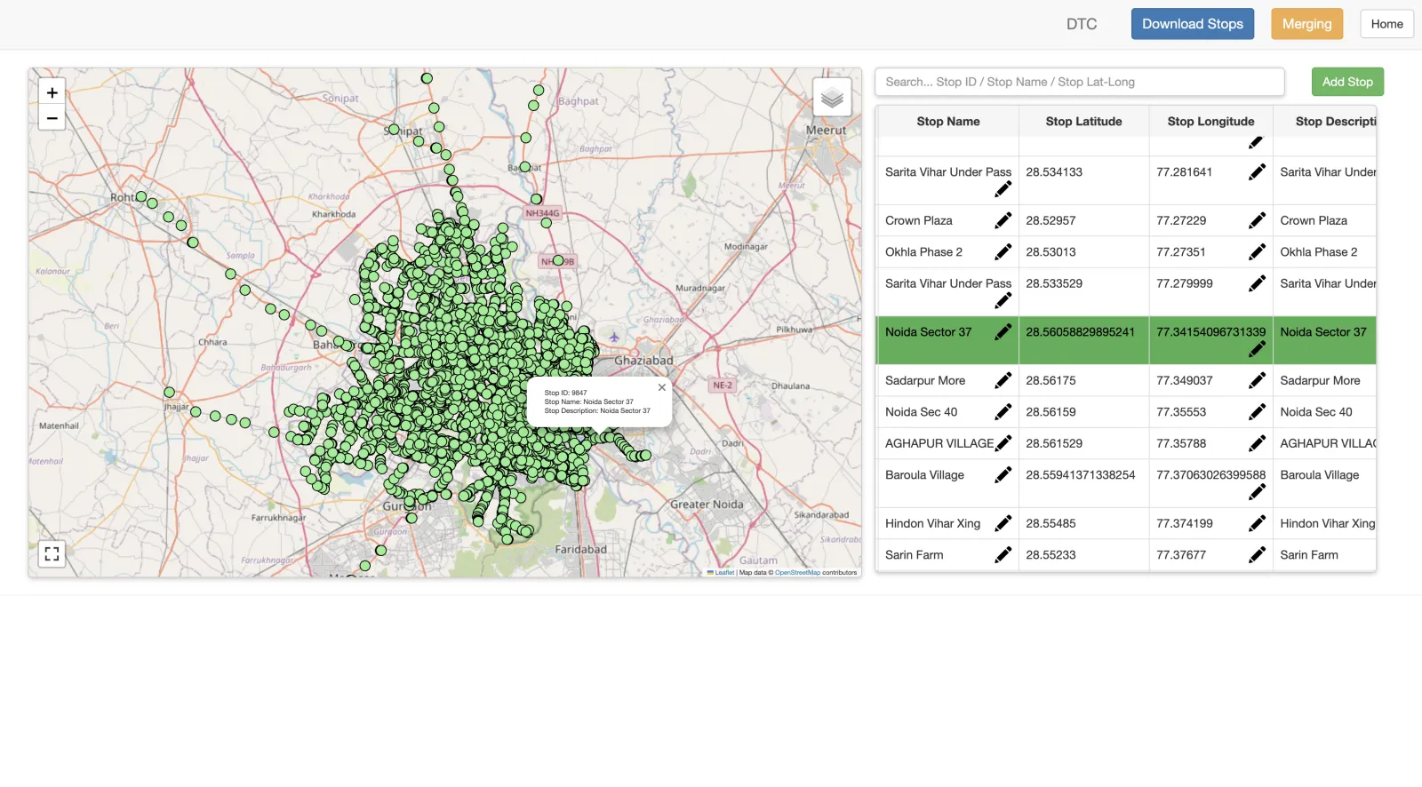
Stop Map & Editor
Every bus stop plotted on a live map. Search by stop ID, name or coordinates. Click any stop to view or edit its details — name, latitude, longitude, description.
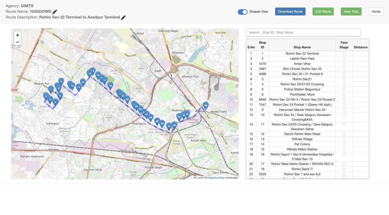
Route View
Visualise any route on an interactive map alongside the full ordered stop list, fare stages and distances. Download the route data directly.
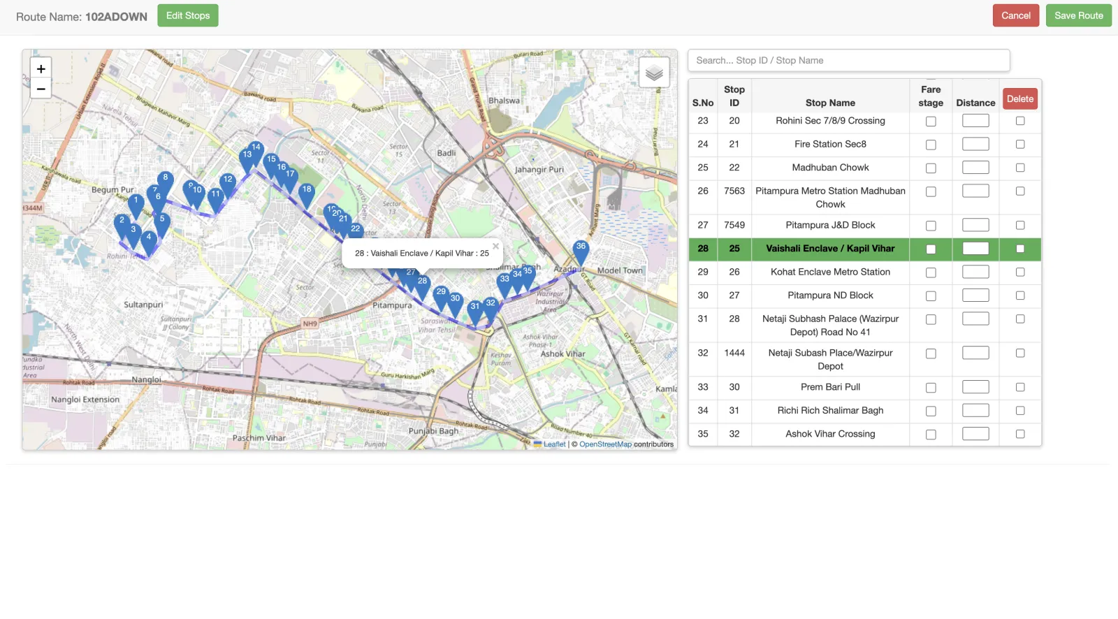
Route Editor
Add, reorder and remove stops along any route directly on the map. Set fare stages and distances — no spreadsheet needed.
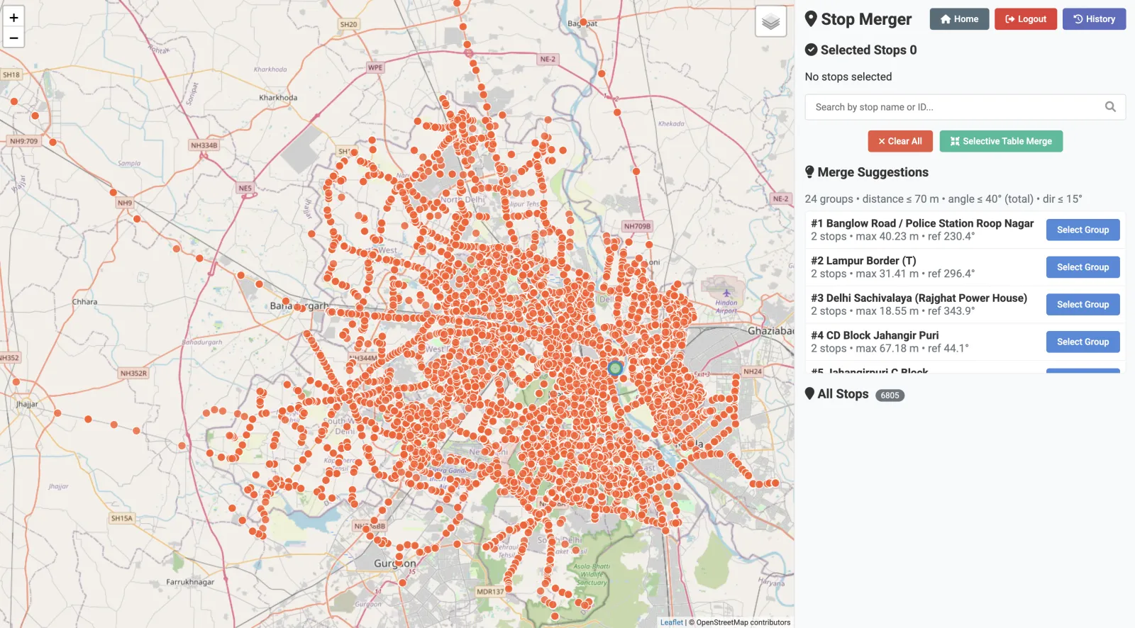
Stop Merger
Duplicate stops are a common problem in large networks. The Stop Merger detects nearby stops (within 70m) and suggests which to merge — with one click per group.
Impact
What a GTFS dataset unlocks
Visibility on every map app
Google Maps, Apple Maps, Citymapper and more — they all read GTFS. Publish your feed once and riders can find your buses everywhere.
ONDC and app integrations
ONDC seller apps, journey planners and multimodal platforms need GTFS to show your routes and sell your tickets. No GTFS, no integration.
Open, reusable data
Researchers, urban planners and startups can build on your network data. Chartr published India's first open GTFS dataset for Delhi — enabling an entire ecosystem.
Ready to digitise your transit network?
Tell us about your network and we'll show you how to get your routes and stops into GTFS — fast.